 (Page
8 of 9 pages)
 (Page
8 of 9 pages)
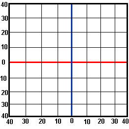
This picture shows how latitude and longitude usually appear on a map.
The red line is the equator. All the latitudes above the equator are North latitudes, and those below are South latitudes
The blue line is the Prime Meridian.
The meridians to the left of the blue lines are West longitudes, and those
to the right are East longitudes.